Well, on Thursday I decided to pull the fuel tank. when We had it running at the PO's we had to put the draw tube in a can of new clean fuel to run.
First I drained the remaining 1.5 gallons of fuel from 2003. Then I pulled the cover off and removed the draw tube. I could not reach the nut holding on the wire to the sender unit so I cut it off. I then set about trying to find the right size wrenches for the mounting hardware. I could get a 1/2 on the nuts for the front and took 2 off and loosened the last one.
The 3 in the rear were much harder to do. first I could not find the top/unseen parts of the hardware. I spent about 15 minutes until I finally found them in a small recess inside the outrigger. Of course the 1/2 spanner would not fit. Oh, I could still use my 1/2 socket on the bottom but the inside ones turned out to be 13mm.
Finally I removed those and then took out the front remaining one of the unsupported tank. I fully expected it to fall to the ground??? Ummm did not undo the fill hoses yet... Set to them with a screwdriver and it still did not fall.......A little shove and WHAM!!! it hit the ground.
Scooching it out from underneath I took it over to a bucket and drained the remains,,,,YUCK! The inside of the tank was covered in rust and a 1/8in layer of rust chips covered the bottom.
Time for a new tank! I have a NOS tank been sitting in the back of my daughters 88 since 1996. So I dragged it out from under the junk and peaked inside. Some light surface rust and I am not sure I can save it. I can use it but it will rust out eventually. Perhaps after I have passed,,....
I then went to work on the heavily corroded fuel sender unit. The float will not move. I cleaned off the corrosion and lubed up the float shaft with some Slick 50.
Then I removed the top and peered inside, nothing looked broken or jammed so out came the Vise Grips and I put pressure on the float shaft. Slowly it gave way to torque and after about a half dozen rotations it was sufficently free to move by itself!
I put it all back together and painted it. Painting tells me I am finished with that job.
Moving on I put my daughters battery in and hooked up the cables. Turning on the light switch revealed that the head lights don't work, There is no horn(in a box). The dash panel was ziptied to the bulkhead so I cut it loose and found the PO had replaced some(all) the wires comming off the ignition with red wires.And Yes the ground wires are white.....
Of course you can't tell where they go to.... They all will have to come out anyway either to replace the bulkhead or paint it. So probably looking at a new wiring harness.
Then I quit for the day.
Today I did some online research for the seal necessary to do the roof and bulkhead. The trouble I'm having is the books and suppliers all list roof seals for a 109 Station Wagon(5door) while my 109 is a regular(3 door). I think they would take different seals as the sides are twice as long. I could be wrong but I dislike making the mistake and having to wait while the correct part is shipped.
Friday, April 15, 2011
Friday, April 8, 2011
109 bought and ready to fix up
So I have always wanted a 3 door 109 Land Rover. Since it is just me now I don't need to seat 4-5 peoples.
I finally got a lead on one about 80 miles away. I called the number and went the next day to look at it, I liked what I saw and made a bid. Two weeks later I was notified that I was the new owner of a 1960 Series 2 109 regular(3 door).
I got it for $800US which I paid 2 days later. I needed to arrange to get it home and thought my daughters boyfriend could borrow a trailer and bring it over but that did not work out. So almost 3 weeks later on 4-5-2011 I finally went and rented a tow dolly with my friend Brian and we pulled it out of the field with my 88 and towed it home with my 93 Rangie.
The next day Wed I spent cleaning it up I started on the roof scrubbing off the moss and mould and in alot of places the thin veneer of paint. Then I worked my way down the sides, the right side was the worst, with most of the moss on the roofside. I did the wings and rear door.
After lunch I started on the inside by removing the rearprop shaft and bumper some rags and plastic sheeting left inside. About 3/4 of the bed was coated in oil this took 3 washings of Dawn dishsoap and rinsing with a hose to clean out.
The next thing to go was the insulation left over from the headliner. I got out a sprayer and wetted it down then used a putty knife to scrape it off, leaving only the black adhesive residue. During the whole cleaning process I must have disposed of half a dozen spiders and lots of webbing.
The 109 was purchased by the previous owners father in 1961. It was last tagged in 2003 and has a non-op on it ever since. It has always been a California car sold in San Jose and living mainly in the Sonoma area then Pescadero and Prunedale. The orginal owner removed the fixed windows and put in aftermarket sliders. That and a crank driven winch are the only aftermarket changes I can see from a stock 109 regular.
On Thursday it rained in the morning so after things dried out a bit I was able to put some lube on the capstan fittings then went to work on some of the dents. I had bought a body hammer that day and tried to see what I could do. The body damage is a big dent in the right rear where it was backed into a log, only bending the corner and side not the crossmember. The right front outer wing had a dinner plate size dent in it up by the front while the left wing was pushed in and down resulting in a v bend in the inner panel and pushed out outer panel and bent up top panel at the radiator panel.
This is after I did some work on it. I still need to have someone help me to hold a brace on the inside so I can further straighten it up.
Then it was on to the dent in the roof above the driver. It looked like a tree branch or some thing fell across it. A few well placed hits with my trusty piece of narrow guage railroad track did the trick followed by some shaping with my new hammer.
Today I was able to remove the Capstan winch. I had to cut the bolts holding it to the front cross member as the rivenuts just turned in thier holes. That was an ordeal in itself requiring my reciprocating saw and 3 blades! I only cut the frame in one spot....... Now I only have to remove the winch drive nut.
So that is where I am as of today. I have plans for it's future and it will depend on money and time of course. Being unemployed I have plenty of the latter.
My dream for it would be strip it down and if the frame is not bad either wire brush and paint/powder coat or galvanize it. I need to replace the bulkhead and windscreen frame as there is a lot of rust on the right hand side. Then I can paint the body and start reassembly. I can drop in the 2.5 diesel turbo I have and put an LT230 transmission behind it. Maybe I can get one from a junkyard Disco or Rangie.
Also get the front and rear axles with disc brakes and 24 spline halfshafts and put them on parabolic springs. Put in my spare overdrive a CB and stereo, new headliner insulation and headliner, dynamat things as it goes back together. I want to put in a rear heater that I have left over from my 88 when I put in a Kodiak mk3 and fix up a removable sleeping/camping set up.
I know I forgot stuff but that's enough for now. Have a great day!
I finally got a lead on one about 80 miles away. I called the number and went the next day to look at it, I liked what I saw and made a bid. Two weeks later I was notified that I was the new owner of a 1960 Series 2 109 regular(3 door).
I got it for $800US which I paid 2 days later. I needed to arrange to get it home and thought my daughters boyfriend could borrow a trailer and bring it over but that did not work out. So almost 3 weeks later on 4-5-2011 I finally went and rented a tow dolly with my friend Brian and we pulled it out of the field with my 88 and towed it home with my 93 Rangie.
The next day Wed I spent cleaning it up I started on the roof scrubbing off the moss and mould and in alot of places the thin veneer of paint. Then I worked my way down the sides, the right side was the worst, with most of the moss on the roofside. I did the wings and rear door.
After lunch I started on the inside by removing the rearprop shaft and bumper some rags and plastic sheeting left inside. About 3/4 of the bed was coated in oil this took 3 washings of Dawn dishsoap and rinsing with a hose to clean out.
The next thing to go was the insulation left over from the headliner. I got out a sprayer and wetted it down then used a putty knife to scrape it off, leaving only the black adhesive residue. During the whole cleaning process I must have disposed of half a dozen spiders and lots of webbing.
The 109 was purchased by the previous owners father in 1961. It was last tagged in 2003 and has a non-op on it ever since. It has always been a California car sold in San Jose and living mainly in the Sonoma area then Pescadero and Prunedale. The orginal owner removed the fixed windows and put in aftermarket sliders. That and a crank driven winch are the only aftermarket changes I can see from a stock 109 regular.
On Thursday it rained in the morning so after things dried out a bit I was able to put some lube on the capstan fittings then went to work on some of the dents. I had bought a body hammer that day and tried to see what I could do. The body damage is a big dent in the right rear where it was backed into a log, only bending the corner and side not the crossmember. The right front outer wing had a dinner plate size dent in it up by the front while the left wing was pushed in and down resulting in a v bend in the inner panel and pushed out outer panel and bent up top panel at the radiator panel.
This is after I did some work on it. I still need to have someone help me to hold a brace on the inside so I can further straighten it up.
Then it was on to the dent in the roof above the driver. It looked like a tree branch or some thing fell across it. A few well placed hits with my trusty piece of narrow guage railroad track did the trick followed by some shaping with my new hammer.
Today I was able to remove the Capstan winch. I had to cut the bolts holding it to the front cross member as the rivenuts just turned in thier holes. That was an ordeal in itself requiring my reciprocating saw and 3 blades! I only cut the frame in one spot....... Now I only have to remove the winch drive nut.
So that is where I am as of today. I have plans for it's future and it will depend on money and time of course. Being unemployed I have plenty of the latter.
My dream for it would be strip it down and if the frame is not bad either wire brush and paint/powder coat or galvanize it. I need to replace the bulkhead and windscreen frame as there is a lot of rust on the right hand side. Then I can paint the body and start reassembly. I can drop in the 2.5 diesel turbo I have and put an LT230 transmission behind it. Maybe I can get one from a junkyard Disco or Rangie.
Also get the front and rear axles with disc brakes and 24 spline halfshafts and put them on parabolic springs. Put in my spare overdrive a CB and stereo, new headliner insulation and headliner, dynamat things as it goes back together. I want to put in a rear heater that I have left over from my 88 when I put in a Kodiak mk3 and fix up a removable sleeping/camping set up.
I know I forgot stuff but that's enough for now. Have a great day!
Sunday, February 6, 2011
Great Divide Mountain Bike Route, 2003 page 4
Tues 4-15-2003 Seely Lake, Montana
Today we took a rest day, we hung around after sleeping in at the Big Larch Campgrounds. A day to do laundry, ride to town for groceries and swim in Seely lake itself. I checked over the bikes, lubing chains and adjusting brakes.
It felt great to not HAVE to ride today!
Todays stats;
saddle time 42min 41sec
average spd 11.2 max 19.3
dist 8mi total dist 420.9
climb 1,200ft tot climb 31,800ft
Wed 7-16-2003 Seely Lake to Big Nelson Campgrounds on Cooper Lake
Even before we started I had to fix a flat this morning! Still we left at 0800 on a sunny day. It turned out to be soo hot! We climbed along the dirt roads up to the Cottonwood Lakes where we startled a great blue heron as we came around a corner.
After passing the Monture Work Center we left the Lolo National forest and entered agricultural valleys. We had to cross one valley floor with no trees in the hot sun that took us at least and hour. Upon reaching the shade ot the trees on the other side I pulled out my rain fly and we laid upon it waiting away the heat of the day.
Even though we were only a few yards from the side of the road the guy spraying for noxious weeds did not stop spraying as he passed! Of the few cars to pass noone stopped to ask if we were ok. So as time went by we shifted our position to stay in the rotating shade and talked of cold drinks and ice cream in the intense heat.
After a couple of hours we packed up and left headed to camp on a dusty hot dirt road. At one point while I was in the lead a truck passed by without slowing filling the air with foul dust. Some half mile later as I rounded a bend I saw the same truck pulled over. I thought he was checking his mail when out he gets and says to me " I am sorry for all the dust, would you like a popsicle?" Well I could not believe it and of course enthusiasticly said yes! As he was getting them out of his cooler Lynn arrived to which he also offered a cold popsicle. As we stood there sucking them down he explained that he was heading home after grocery shopping, hence the bag of popsicles. Turns out he is a trainer of sled dogs and his family moved here to do just this.
It was not much further to Cooper Lake where the camp is nestled on the shore. We set up camp and rinsed clothes cooked dinner and swam in the warm lake, Since we had seen bear tracks earlier in the day we made sure to do a bear hang, this time out over the water.
Stats;
saddle time 4:31:56
avg spd 9.1
max spd 29.1
dist 41.3
tot dist 464.9
climb 2,580
tot climb 34,300
Thurs, 7-17-2003 Cooper Lake to Lincoln
It was an early 0730 start on a cloudless day! We were to find out on our arrival in Helena that Montana was experiencing its worst heat wave in many years. Sometimes ignorance is bliss!
We spotted deer in the marsh and had a 2 mile ride from the camp to the road. Once there it was a 6 mile climb to the top of Hucklberry Pass, which we accomplished by noon.
Our typical day would consist of up at maybe 630 eat oatmeal and break camp and start off riding. We would stop to rest and pee together and to take pictures. A Cliff bar break always occured around 10 to 11 am followed by more riding and a lunch of bagles with peanutbutter and honey.
Then more riding and another Cliff bar around 2-3pm and usually around 4-5pm we would roll into camp. Here we set up tent and bags do wash or pump water and cook dinner. Dinner usually consisted of some type of storebought dry food like Lipton's rice or pasta sides. So all we had to do was boil up water and simmer. Sometimes after leaving a town we would have a piece of fresh fruit with our lunch.
But I digress, on the way to Lincoln on the HOT day we encountered a fellow on on old Shwinn 10spd riding out in the Helena National Forest which we had now entered. He was about 10 miles from town and carried no water. He said he just drank out of the creeks......
Lincoln, Montana used to be the home of the Unabomber. There is not much there I can see why he picked this town. By the time we arrived it was 96 degrees F! So tinto the only place in town the Subway/store/gas station! Hey they had a/c in there! So we spent the next hour and a half eating and writing postcards in the relative cool of the Subway.
After recovering enough to go out and about Lynn and I took in the sights about town and in the sporting goods shop we met a Dutch couple who were doing the Divide going South to North.
We then found camp for the night at the towns Hooper Park that was setting up for the big flea market the next day. After setting up camp we went grocery shopping and the kind lady gave us some free fruit!!
Back at camp we ran into another Divide rider going solo named Alvin. He had left his food in his tent and the critters had gnawed a hole into his tent to get at it.
In a town an I am not cooking dinner so I went to the Pitstop a 50's themed restaurant where I had the 4cyl burger and a huckleberry cone. The cone was sooo good when I got back to camp I made Lynn ride over and get one! At $1.50 and they were HUGE!
Stats;
saddle time 2:57:46
avg spd 7.6
mx spd 30.9
dist 22.5
tot dist 489.6
climb 2,250ft
tot climb 36,400ft
Today we took a rest day, we hung around after sleeping in at the Big Larch Campgrounds. A day to do laundry, ride to town for groceries and swim in Seely lake itself. I checked over the bikes, lubing chains and adjusting brakes.
It felt great to not HAVE to ride today!
Todays stats;
saddle time 42min 41sec
average spd 11.2 max 19.3
dist 8mi total dist 420.9
climb 1,200ft tot climb 31,800ft
Wed 7-16-2003 Seely Lake to Big Nelson Campgrounds on Cooper Lake
Even before we started I had to fix a flat this morning! Still we left at 0800 on a sunny day. It turned out to be soo hot! We climbed along the dirt roads up to the Cottonwood Lakes where we startled a great blue heron as we came around a corner.
After passing the Monture Work Center we left the Lolo National forest and entered agricultural valleys. We had to cross one valley floor with no trees in the hot sun that took us at least and hour. Upon reaching the shade ot the trees on the other side I pulled out my rain fly and we laid upon it waiting away the heat of the day.
Even though we were only a few yards from the side of the road the guy spraying for noxious weeds did not stop spraying as he passed! Of the few cars to pass noone stopped to ask if we were ok. So as time went by we shifted our position to stay in the rotating shade and talked of cold drinks and ice cream in the intense heat.
After a couple of hours we packed up and left headed to camp on a dusty hot dirt road. At one point while I was in the lead a truck passed by without slowing filling the air with foul dust. Some half mile later as I rounded a bend I saw the same truck pulled over. I thought he was checking his mail when out he gets and says to me " I am sorry for all the dust, would you like a popsicle?" Well I could not believe it and of course enthusiasticly said yes! As he was getting them out of his cooler Lynn arrived to which he also offered a cold popsicle. As we stood there sucking them down he explained that he was heading home after grocery shopping, hence the bag of popsicles. Turns out he is a trainer of sled dogs and his family moved here to do just this.
It was not much further to Cooper Lake where the camp is nestled on the shore. We set up camp and rinsed clothes cooked dinner and swam in the warm lake, Since we had seen bear tracks earlier in the day we made sure to do a bear hang, this time out over the water.
Stats;
saddle time 4:31:56
avg spd 9.1
max spd 29.1
dist 41.3
tot dist 464.9
climb 2,580
tot climb 34,300
Thurs, 7-17-2003 Cooper Lake to Lincoln
It was an early 0730 start on a cloudless day! We were to find out on our arrival in Helena that Montana was experiencing its worst heat wave in many years. Sometimes ignorance is bliss!
We spotted deer in the marsh and had a 2 mile ride from the camp to the road. Once there it was a 6 mile climb to the top of Hucklberry Pass, which we accomplished by noon.
Our typical day would consist of up at maybe 630 eat oatmeal and break camp and start off riding. We would stop to rest and pee together and to take pictures. A Cliff bar break always occured around 10 to 11 am followed by more riding and a lunch of bagles with peanutbutter and honey.
Then more riding and another Cliff bar around 2-3pm and usually around 4-5pm we would roll into camp. Here we set up tent and bags do wash or pump water and cook dinner. Dinner usually consisted of some type of storebought dry food like Lipton's rice or pasta sides. So all we had to do was boil up water and simmer. Sometimes after leaving a town we would have a piece of fresh fruit with our lunch.
But I digress, on the way to Lincoln on the HOT day we encountered a fellow on on old Shwinn 10spd riding out in the Helena National Forest which we had now entered. He was about 10 miles from town and carried no water. He said he just drank out of the creeks......
Lincoln, Montana used to be the home of the Unabomber. There is not much there I can see why he picked this town. By the time we arrived it was 96 degrees F! So tinto the only place in town the Subway/store/gas station! Hey they had a/c in there! So we spent the next hour and a half eating and writing postcards in the relative cool of the Subway.
After recovering enough to go out and about Lynn and I took in the sights about town and in the sporting goods shop we met a Dutch couple who were doing the Divide going South to North.
We then found camp for the night at the towns Hooper Park that was setting up for the big flea market the next day. After setting up camp we went grocery shopping and the kind lady gave us some free fruit!!
Back at camp we ran into another Divide rider going solo named Alvin. He had left his food in his tent and the critters had gnawed a hole into his tent to get at it.
In a town an I am not cooking dinner so I went to the Pitstop a 50's themed restaurant where I had the 4cyl burger and a huckleberry cone. The cone was sooo good when I got back to camp I made Lynn ride over and get one! At $1.50 and they were HUGE!
Stats;
saddle time 2:57:46
avg spd 7.6
mx spd 30.9
dist 22.5
tot dist 489.6
climb 2,250ft
tot climb 36,400ft
Saturday, February 5, 2011
Great Divide Mountain Bike Route, 2003 page 3
Sat 7-12-2003 Bigfork to Cedar Creek campground
There was a big hill after an early start for us, something that was to be the regime of the trip. A big hill to start the day off with. It was very hot and we saw very little traffic as we traveled down past Swan Lake. It was 116F in the sun at 4pm.
Something I was to only understand later that even though you are in the forested Rocky Mountains the roads are largely open and without ready shade.
We did find some shade and sat in it from 2 to 4pm. We arrived at the campsite after a long downhill around 6pm. The campgrounds were heavy with mosquitos! I was very tired and there was too much heat! We had chili for dinner.
Todays stats;
Riding time 5.02.16
average spd 7.4mph
max spd 27.2
distance 37.3mi.
total distance 322.7mi.
ascent 5360ft
total asc 24,500ft
Sunday 7-13-2003 Cedar Creek to Holland Lake
We broke camp early to try to beat the heat. You have to backtrack up the hill to the turn off for the route which we had passed on yesterdays downhill. So we rode up and took the first left.
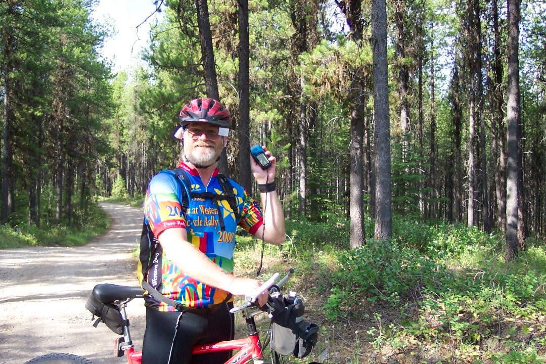
After riding a ways the route sheet and the landmarks did not line up and there were no other bicycle tracks so we knew we were lost! I turned on the Garmin Legend gps I had brought with the topo maps downloaded for just this situation.
We found that we had ridden 4.5 miles out of our way towards Shay Lake!
First we tried to find a way thru on the old logging roads but the one we wanted had a deep gully in it. So we went back to the downhill and climbed up to the proper turn. All in all we lost one and a half hours of valuable "cool" time!
Today turned out to be cloudy with good loong climbs and our first singletrack in the Mission Mountains. Very pretty country and Holland Lake is very nice. We had dinner and went to the Lodge for our first huckleberry soda. The campgrounds were pretty full with RV's and trailers everywhere.
The lodge is expensive back then the filet migion was $22 and Elk medallions 24. To stay there was $95.00 per person per night, but included breakfast and dinner.
Travel time 6.19.03
average spd 7.5
max spd 24.8
dist 47.8
total dist 370.5
climb 3,780ft
total climb 28,100
Monday 7-14-2003 Holland Lake to Seely Lake
It was cool in the morning and after our oatmeal breakfast we headed off. Going along the western edge next to "The Bob", The Bob Marshall Wilderness. At around 10 miles we came to a turn off for Clearwater Lake, It was a short distance off the road down a great singletrack. The lake is exqusite!
We saw deer and loons and wood ducks. Taking to opportunity of the fresh water and isolation we elected to rinse our laundry for the day.
About 3 miles later we started the climb of the day a 5.5mile climb in granny first gear up a beautiful canyon, in the warm sun. We pumped(filtered) water about half way up and drank plenty, it felt good to be riding smart!
After the climb the trail winds along the eastern side of Richmond Peak above Grizzly Basin. This part is double track and becomes single track on the downhill end. We had to cross downed trees and landslides.
The trail is rocky and with close in vegetation. I had my first flat tyre after crossing a downed tree.
Downhill thru Grizzly Basin was the best I've ever done! It has beauty and speed with intermediate to beginner skill level. We saw no griz but did stop to scope out a herd of elk on the opposite side of the basin. At the end of the single track back to the road and we found that Lynn had lost her lock and cable, the one she had had 20 years since high school!
Another couple doing the Divide caught us here Sean and Mimi, both were pulling B.O.B.'s like mine.
We screamed down the fireroad and the top part of my flag came out unknown to me. Lynn also missed seeing it. As I waited for her at a senic overlook I noticed it was missing....Mimi found it and when they caught up to us there she gave it back.
Lynn was tired today, We rode into Seely lake and had fig newtons and gatorade and did some food shopping for the next couple of days. I had a burger and fries and called the kids for the first time in a week.
Riding time 6.00.49
avg spd 6.8
max spd 29.4
dist 41.1mi
total dist 412.8mi some miles in town and camp
today climbing 3,760ft
total climb 31,700ft
There was a big hill after an early start for us, something that was to be the regime of the trip. A big hill to start the day off with. It was very hot and we saw very little traffic as we traveled down past Swan Lake. It was 116F in the sun at 4pm.
Something I was to only understand later that even though you are in the forested Rocky Mountains the roads are largely open and without ready shade.
We did find some shade and sat in it from 2 to 4pm. We arrived at the campsite after a long downhill around 6pm. The campgrounds were heavy with mosquitos! I was very tired and there was too much heat! We had chili for dinner.
Todays stats;
Riding time 5.02.16
average spd 7.4mph
max spd 27.2
distance 37.3mi.
total distance 322.7mi.
ascent 5360ft
total asc 24,500ft
Sunday 7-13-2003 Cedar Creek to Holland Lake
We broke camp early to try to beat the heat. You have to backtrack up the hill to the turn off for the route which we had passed on yesterdays downhill. So we rode up and took the first left.
After riding a ways the route sheet and the landmarks did not line up and there were no other bicycle tracks so we knew we were lost! I turned on the Garmin Legend gps I had brought with the topo maps downloaded for just this situation.
We found that we had ridden 4.5 miles out of our way towards Shay Lake!
First we tried to find a way thru on the old logging roads but the one we wanted had a deep gully in it. So we went back to the downhill and climbed up to the proper turn. All in all we lost one and a half hours of valuable "cool" time!
Today turned out to be cloudy with good loong climbs and our first singletrack in the Mission Mountains. Very pretty country and Holland Lake is very nice. We had dinner and went to the Lodge for our first huckleberry soda. The campgrounds were pretty full with RV's and trailers everywhere.
The lodge is expensive back then the filet migion was $22 and Elk medallions 24. To stay there was $95.00 per person per night, but included breakfast and dinner.
Travel time 6.19.03
average spd 7.5
max spd 24.8
dist 47.8
total dist 370.5
climb 3,780ft
total climb 28,100
Monday 7-14-2003 Holland Lake to Seely Lake
It was cool in the morning and after our oatmeal breakfast we headed off. Going along the western edge next to "The Bob", The Bob Marshall Wilderness. At around 10 miles we came to a turn off for Clearwater Lake, It was a short distance off the road down a great singletrack. The lake is exqusite!
We saw deer and loons and wood ducks. Taking to opportunity of the fresh water and isolation we elected to rinse our laundry for the day.
About 3 miles later we started the climb of the day a 5.5mile climb in granny first gear up a beautiful canyon, in the warm sun. We pumped(filtered) water about half way up and drank plenty, it felt good to be riding smart!
After the climb the trail winds along the eastern side of Richmond Peak above Grizzly Basin. This part is double track and becomes single track on the downhill end. We had to cross downed trees and landslides.
The trail is rocky and with close in vegetation. I had my first flat tyre after crossing a downed tree.
Downhill thru Grizzly Basin was the best I've ever done! It has beauty and speed with intermediate to beginner skill level. We saw no griz but did stop to scope out a herd of elk on the opposite side of the basin. At the end of the single track back to the road and we found that Lynn had lost her lock and cable, the one she had had 20 years since high school!
Another couple doing the Divide caught us here Sean and Mimi, both were pulling B.O.B.'s like mine.
We screamed down the fireroad and the top part of my flag came out unknown to me. Lynn also missed seeing it. As I waited for her at a senic overlook I noticed it was missing....Mimi found it and when they caught up to us there she gave it back.
Lynn was tired today, We rode into Seely lake and had fig newtons and gatorade and did some food shopping for the next couple of days. I had a burger and fries and called the kids for the first time in a week.
Riding time 6.00.49
avg spd 6.8
max spd 29.4
dist 41.1mi
total dist 412.8mi some miles in town and camp
today climbing 3,760ft
total climb 31,700ft
Saturday, January 22, 2011
Great Divide Mountain Bike Route 2003 page 2
On July eighth of 03 saw us leave our bandit camp on Graves Creek Rd and ride thru our intended camp site at Tuchuk campgrounds. Here we found many mosquitos and we were the only food on the menu! Quick to leave and glad we didn't make it here last night. This part of Montana is beautiful, not yet the "Big Sky Country" but bear country as evidenced by the scat we found.
We crossed the Whitefish Divide walking thru the snow.
The pass had been offically opened just 4 days earlier. Eventually we came to North Fork Rd on the Western side of Glacier National Park. Along the way we came across 2 men cutting up firewood from downed trees. Here at an old homestead we stopped for lunch.
We saw bald eagle and western tanagers. There was a badass climb up to Red Meadow Lake tonites campsite as recommended by the guide book. Getting there put us back on schedule.
It was sooo pretty!! With MUCHO mosquitos! Now my second bear hang and I think I have perfected my technique. Now bears again and only 1 car drove by all day. We really felt like we were "out there" Just what I had dreamed about when first reading about the Pacific Crest Trail.
After dinner and setting up camp I looked over the bikes and made some adjustments.
July 9 2003
Waking up to a chilly morning Lynn and I cooked oatmeal and broke camp.
Since we had crossed the Whitefish Divide yesterday there was a great downhill awaiting us today. The downhill took us along the Eastern side of Upper Whitefish Lake and into Whitefish itself.
This night we camped along the Flathead River at Catharine's brothers house. Here we were able to swim in the river and get cleaned up.
We had ridden 9h 56m for 226.8mi
July 10 2003
After a restfull night on the comfy grass we said goodbye to our new friends and pedaled off around 10 am. Only an hour later and Lynn is struggling to keep up and is having bike problems. Over the years she has worn out her front rim from constant braking and the brake pad has gotton stuck under the rim.
We decided that she need to get her bike repaired back in Whitefish. So I stay there with all the gear while she rides back to get a new wheel. Around 2pm Lynn and Catherine return in a car. We have now decided to use one of our rest days because we have lost so much time today. So back to Whitefish, this time to Catherines parents house on the lake, which we took advantage of and swam in. Also laundry was done.
After dinner Catherine decided to join us for the ride to Bigfork where she will be picked up by Tanya her sis-in-law.
Not to far today only 233.7 total miles. A big 6.9 miles today!
July 11 2003 Whitefish to Bigfork
HOT 93F! Catherine rode with us today, she unloaded, Lynn with her panniers and I with my trailer. It must have been easy for her to keep up! We had a flat and met Tom Arnonne riding along the way. He invited us to his place for a rest stop where we met his wife, Patty,
and got to see his bike collection.
Arriving in Bigfork we stayed at the Wayfarers State Park. Had dinner in town and went grocery shopping for the next 3 days supplies. This time we swam in Flathead Lake, it was huge warm and rocky, and had showers!
time 4h57m55s dist 51.5mi total dist 285.2mi average speed 10.4mph
We crossed the Whitefish Divide walking thru the snow.
The pass had been offically opened just 4 days earlier. Eventually we came to North Fork Rd on the Western side of Glacier National Park. Along the way we came across 2 men cutting up firewood from downed trees. Here at an old homestead we stopped for lunch.
We saw bald eagle and western tanagers. There was a badass climb up to Red Meadow Lake tonites campsite as recommended by the guide book. Getting there put us back on schedule.
It was sooo pretty!! With MUCHO mosquitos! Now my second bear hang and I think I have perfected my technique. Now bears again and only 1 car drove by all day. We really felt like we were "out there" Just what I had dreamed about when first reading about the Pacific Crest Trail.
After dinner and setting up camp I looked over the bikes and made some adjustments.
July 9 2003
Waking up to a chilly morning Lynn and I cooked oatmeal and broke camp.
Since we had crossed the Whitefish Divide yesterday there was a great downhill awaiting us today. The downhill took us along the Eastern side of Upper Whitefish Lake and into Whitefish itself.
This night we camped along the Flathead River at Catharine's brothers house. Here we were able to swim in the river and get cleaned up.
We had ridden 9h 56m for 226.8mi
July 10 2003
After a restfull night on the comfy grass we said goodbye to our new friends and pedaled off around 10 am. Only an hour later and Lynn is struggling to keep up and is having bike problems. Over the years she has worn out her front rim from constant braking and the brake pad has gotton stuck under the rim.
We decided that she need to get her bike repaired back in Whitefish. So I stay there with all the gear while she rides back to get a new wheel. Around 2pm Lynn and Catherine return in a car. We have now decided to use one of our rest days because we have lost so much time today. So back to Whitefish, this time to Catherines parents house on the lake, which we took advantage of and swam in. Also laundry was done.
After dinner Catherine decided to join us for the ride to Bigfork where she will be picked up by Tanya her sis-in-law.
Not to far today only 233.7 total miles. A big 6.9 miles today!
July 11 2003 Whitefish to Bigfork
HOT 93F! Catherine rode with us today, she unloaded, Lynn with her panniers and I with my trailer. It must have been easy for her to keep up! We had a flat and met Tom Arnonne riding along the way. He invited us to his place for a rest stop where we met his wife, Patty,
and got to see his bike collection.
Arriving in Bigfork we stayed at the Wayfarers State Park. Had dinner in town and went grocery shopping for the next 3 days supplies. This time we swam in Flathead Lake, it was huge warm and rocky, and had showers!
time 4h57m55s dist 51.5mi total dist 285.2mi average speed 10.4mph
Friday, January 21, 2011
Great Divide Mountain Bike Route, 2003
I have to go into the wayback machine for this Mr. Peabody!
In the early 1970's National Geographic came out with an article about the Pacific Crest Trail. A 2000mi+ hiking trail along the Serria Nevada and Cascade ranges from Canada to Mexico. I was in the Navy at the time and the idea caught my fancy. I kept the magazine hoping to do the trek when I got out.
Well, I did not. Instead I got a job and a motorcycle, Land Rover. Then hit by a car on my bike breaking my ankle in 3 places. During recovery I met a woman and fell in love. We married, had kids and went on Rover trips to the Black Rock Desert.
Fast forward to the late 1990's, mountain bikes have been around for over a decade, a company dedicated to bicycle touring( Adventure Cycling Assoc.)has created a route from Canada to Mexico following the Continental Divide of the Rocky Mtns. Once again I read about it in a magazine.
Now divorced and kid free, an avid cyclist and mountain biker in 2003 I start planning and seeking other riders. Starting with 10 peoples when it came time to go only one other stood with me at the starting line. Now my good friend Lynn.
In 2003 we rode from Port of Rooseville, Montana to Helena, Montana.
What follows is the story of that first leg of our journey.
We had found a way to have a car shuttle from Whitefish, Mt. to Clancy, Mt. just south of Helena, so we drove Lynn's car up Calif thru Oregon to Washington across Idaho and ended in Whitfish at one of Lynn's friends house Catherine.
The following day we rode up the 2 lane highway to the town of Eureka, Mt. Just a few miles south of the Canadian border. Here we pitched camp and the next day with our bikes not so heavely loaded rode up to the border and followed the route back to Eureka.
In Eureka I had to get my rear hub adjusted as it was llose and making shifting hard. Back in camp we met Slim and Diane they were doing the GDMBR on dirt bikes.
Then we packed up and started south on the GDMBR. Our first camping destination was to be Tuchuk campgrounds. It was very pretty and hot on this seventh day of July in 2003.
We found the going tough and the hills long as we climbed up them on Graves Road our first off pavement ride. Along the way we ran into a US Border patrolman who teased us about being on the wrong road!
As the ride progressed we decided not to make for Tuchuk and instead camped along Graves Creek, Here I learned how to do a double bear hang. I discovered I packed too much food and we were not bothered by bears that night.
In 4:22 of riding we had covered 35 miles with 14,700ft of climbing! No wonder we were tired.
In the early 1970's National Geographic came out with an article about the Pacific Crest Trail. A 2000mi+ hiking trail along the Serria Nevada and Cascade ranges from Canada to Mexico. I was in the Navy at the time and the idea caught my fancy. I kept the magazine hoping to do the trek when I got out.
Well, I did not. Instead I got a job and a motorcycle, Land Rover. Then hit by a car on my bike breaking my ankle in 3 places. During recovery I met a woman and fell in love. We married, had kids and went on Rover trips to the Black Rock Desert.
Fast forward to the late 1990's, mountain bikes have been around for over a decade, a company dedicated to bicycle touring( Adventure Cycling Assoc.)has created a route from Canada to Mexico following the Continental Divide of the Rocky Mtns. Once again I read about it in a magazine.
Now divorced and kid free, an avid cyclist and mountain biker in 2003 I start planning and seeking other riders. Starting with 10 peoples when it came time to go only one other stood with me at the starting line. Now my good friend Lynn.
In 2003 we rode from Port of Rooseville, Montana to Helena, Montana.
What follows is the story of that first leg of our journey.
We had found a way to have a car shuttle from Whitefish, Mt. to Clancy, Mt. just south of Helena, so we drove Lynn's car up Calif thru Oregon to Washington across Idaho and ended in Whitfish at one of Lynn's friends house Catherine.
The following day we rode up the 2 lane highway to the town of Eureka, Mt. Just a few miles south of the Canadian border. Here we pitched camp and the next day with our bikes not so heavely loaded rode up to the border and followed the route back to Eureka.
In Eureka I had to get my rear hub adjusted as it was llose and making shifting hard. Back in camp we met Slim and Diane they were doing the GDMBR on dirt bikes.
Then we packed up and started south on the GDMBR. Our first camping destination was to be Tuchuk campgrounds. It was very pretty and hot on this seventh day of July in 2003.
We found the going tough and the hills long as we climbed up them on Graves Road our first off pavement ride. Along the way we ran into a US Border patrolman who teased us about being on the wrong road!
As the ride progressed we decided not to make for Tuchuk and instead camped along Graves Creek, Here I learned how to do a double bear hang. I discovered I packed too much food and we were not bothered by bears that night.
In 4:22 of riding we had covered 35 miles with 14,700ft of climbing! No wonder we were tired.
Monday, January 17, 2011
Volcanic Death Valley
All,
On Nov. 18th 2010 Vincent and I left the San Jose area around noon to go to DV on a trip with the Southern California Land Rover Club(SCLR.org).
We drove down to Ridgecrest and spent the night in a motel. The plan was to meet at the Trona Pinnacles at 0830 on Friday. After breakfast we headed out following the instructions from Mr. Garmin. Well he took us the long way around and we came in the back door down road 143 that hadn't been graded since the Plistocene Era! It was like driving on top of the ocean waves in a tight swell ~~~~~~~
The view was fantastic when we arrived and we drove thru the pinnacles
and found the group.
The trip leader Frank came and introduced himself. Quickly a couple of other Rovers showed up and soon there were 13 coilers at Trona. After instructions we took off North thru Trona and after about 7.5 miles turned onto a dirt road headed East over the Slate Range.
This road was to take us to Fish Canyon along the escape route of the Bennet-Arcane families from Death Valley. From there to go north to Ballarat and do the Pleasant Canyon Loop and finish in Furnace Creek by sundown.
The Slate Range trail was fun and not difficult with great views from the ridge tops of the Panamint Valley and the Briggs mine. Once you get to the entrance of Fish Canyon you find the marker
for Father Fish, a 49'er who died there whose body was found by the Bennet-Arcane families, also 49'ers.
The weather was mostly sunny and probably in the low 70's with a chill gusty wind.
At the base of the alluvial fan we turned North and headed towards Ballarat. Alan was on the radio talking about the volcanic and tetonic action in the valley.
A quick break in Ballarat alors down the Wingate road to South Park Canyon Rd, an inoccuous left turn onto a dirt track. Climbing up the switchbacks proved tough for the stock Disco's and one imparticular. A couple of shelf road sections and we were into the canyon itself. Loose rock and sand in a couple of hundred yards we came to a low rocky step. Carlos' Disco
couldn't make it up and after several tries and some effort by Eric to engage the center diff lock(cdl) an hour and a half later it was decided to turn around as we were blocking the tightest spot in the canyon and it was already 2 pm. The loop takes 6.5hrs travel time. Carlos had more trouble getting out of the canyon and we made it the 70 miles to Furnace Creek just after dark.
Vincent and I headed to camp
while the (most) of the rest went to the Furnace Creek Ranch Hotel. After our dinner of salami, cheese and burgers we went and asked about the morning meeting.
Saturday found us meeting at by the temporary Visitors Center at 0830. A quick talk and onto refueling and airing down and now we are 17 coilers. Then the lineup photos,,,,,Oh now we are moving to Marble Canyon.....stop for something in Stovepipe Wells....onto the dirt to Marble........ A long dusty track to the canyon opening, easy going we got to the entrance of the canyon
and hiked into the volcanic upheaval and marble deposition of the canyon. Here we encountered 2 tarantula spiders also hiking the canyon. I hung back and listened to the solitude of the canyon and took some panorama photos of the canyon walls. Because of my ankle I could not go all the way with the group and hear all of Alan's descriptions so I tried to grok the area I was in.
Upon returning to the vehicles lunch was eaten and then Alan gave a good talk about the tectonic and volcanic action of the park and the earthquake faults which resulted from the volcanic action.
Soon we exit the canyon and drove right past the petroglyphs???? The plan was to go to Mosaic Canyon next and then to Zabriskie Point for sunset. Well due to Vincents knowledge of the Valley we decided it was too late to do both and we opted for Zabriskie and the sunset. I was not disappointed there was much beauty to be seen there! We arrived in a very gusty wind, about 20 min prior to sunset. Most visitors just came up looked and left it was so windy and cold, at times it almost knocked you over.
Returning to Furnace Creek we explored the solar array that I found when checking out the Valley on GoogleEarth. As we headed back to camp the others came in from Mosaic, it was about 30 min after sunset.
Sunday morning we broke camp and got to the visitor center by 0800 so I could go shopping before the 0830 meeting. At the meeting Frank awarded Alan a membership to the SCLR, #1000 as a thank you for doing the trips.
Off we go the quarter mile to the refuel station $4.50/gal premium and take off for Chloride City Trail. Headed towards Beatty, Nv. and turning off on to the unmarked dirt road. Fairly easy trail with some high clearance issues, we passed an astounded mountain biker going our way. I bet he thought he was going to be all alone! At Chloride Cliffs the view is astounding!
You can see the southern end of Death Valley at the Owlshead Mtns, to the north end where Ubhebe Crater resides. In between you can see Badwater, lowest point, Telescope Peak, highest point. You can locate Furnace Creek and Stovepipe Wells, Whitetop Mtn and you can look over the Cottonwood Part of the Panamint range and see the tops of the Inyos on the other side of Saline Valley. Truly spectacular, GO THERE!
Vincent an I checked out a mine and we were off for Titus Canyon. On the way Shah hit a boulder in the road and got a flat that slowed us down and Vincent and I decided to forgo Titus so we could get home at a somewhat managable hour. It was an 8+ hr drive. When we stopped to say goodbye at the paved road it was snowing, not much but a few flakes. Goodbyes said we aired up and departed. On the way home we took pictures of the snow on Telescope Peak,
Cerro Gordo(Linus and I went there July, Vincent went with Marie Claire(his fiance) a few weeks later)
I got home about midnight. Same time as the trip leader. All in all I had a great time and learned a good deal about the volcanic Death Valley. I had to get a new camera and this one takes the panorama photos which took me awhile to learn.
Thanks to Vincent for putting up with me! To Frank and Alan for organizing, to Simon and Nina for thier hospitality.
On Nov. 18th 2010 Vincent and I left the San Jose area around noon to go to DV on a trip with the Southern California Land Rover Club(SCLR.org).
We drove down to Ridgecrest and spent the night in a motel. The plan was to meet at the Trona Pinnacles at 0830 on Friday. After breakfast we headed out following the instructions from Mr. Garmin. Well he took us the long way around and we came in the back door down road 143 that hadn't been graded since the Plistocene Era! It was like driving on top of the ocean waves in a tight swell ~~~~~~~
The view was fantastic when we arrived and we drove thru the pinnacles
and found the group.
The trip leader Frank came and introduced himself. Quickly a couple of other Rovers showed up and soon there were 13 coilers at Trona. After instructions we took off North thru Trona and after about 7.5 miles turned onto a dirt road headed East over the Slate Range.
This road was to take us to Fish Canyon along the escape route of the Bennet-Arcane families from Death Valley. From there to go north to Ballarat and do the Pleasant Canyon Loop and finish in Furnace Creek by sundown.
The Slate Range trail was fun and not difficult with great views from the ridge tops of the Panamint Valley and the Briggs mine. Once you get to the entrance of Fish Canyon you find the marker
for Father Fish, a 49'er who died there whose body was found by the Bennet-Arcane families, also 49'ers.
The weather was mostly sunny and probably in the low 70's with a chill gusty wind.
At the base of the alluvial fan we turned North and headed towards Ballarat. Alan was on the radio talking about the volcanic and tetonic action in the valley.
A quick break in Ballarat alors down the Wingate road to South Park Canyon Rd, an inoccuous left turn onto a dirt track. Climbing up the switchbacks proved tough for the stock Disco's and one imparticular. A couple of shelf road sections and we were into the canyon itself. Loose rock and sand in a couple of hundred yards we came to a low rocky step. Carlos' Disco
couldn't make it up and after several tries and some effort by Eric to engage the center diff lock(cdl) an hour and a half later it was decided to turn around as we were blocking the tightest spot in the canyon and it was already 2 pm. The loop takes 6.5hrs travel time. Carlos had more trouble getting out of the canyon and we made it the 70 miles to Furnace Creek just after dark.
Vincent and I headed to camp
while the (most) of the rest went to the Furnace Creek Ranch Hotel. After our dinner of salami, cheese and burgers we went and asked about the morning meeting.
Saturday found us meeting at by the temporary Visitors Center at 0830. A quick talk and onto refueling and airing down and now we are 17 coilers. Then the lineup photos,,,,,Oh now we are moving to Marble Canyon.....stop for something in Stovepipe Wells....onto the dirt to Marble........ A long dusty track to the canyon opening, easy going we got to the entrance of the canyon
and hiked into the volcanic upheaval and marble deposition of the canyon. Here we encountered 2 tarantula spiders also hiking the canyon. I hung back and listened to the solitude of the canyon and took some panorama photos of the canyon walls. Because of my ankle I could not go all the way with the group and hear all of Alan's descriptions so I tried to grok the area I was in.
Upon returning to the vehicles lunch was eaten and then Alan gave a good talk about the tectonic and volcanic action of the park and the earthquake faults which resulted from the volcanic action.
Soon we exit the canyon and drove right past the petroglyphs???? The plan was to go to Mosaic Canyon next and then to Zabriskie Point for sunset. Well due to Vincents knowledge of the Valley we decided it was too late to do both and we opted for Zabriskie and the sunset. I was not disappointed there was much beauty to be seen there! We arrived in a very gusty wind, about 20 min prior to sunset. Most visitors just came up looked and left it was so windy and cold, at times it almost knocked you over.
Returning to Furnace Creek we explored the solar array that I found when checking out the Valley on GoogleEarth. As we headed back to camp the others came in from Mosaic, it was about 30 min after sunset.
Sunday morning we broke camp and got to the visitor center by 0800 so I could go shopping before the 0830 meeting. At the meeting Frank awarded Alan a membership to the SCLR, #1000 as a thank you for doing the trips.
Off we go the quarter mile to the refuel station $4.50/gal premium and take off for Chloride City Trail. Headed towards Beatty, Nv. and turning off on to the unmarked dirt road. Fairly easy trail with some high clearance issues, we passed an astounded mountain biker going our way. I bet he thought he was going to be all alone! At Chloride Cliffs the view is astounding!
You can see the southern end of Death Valley at the Owlshead Mtns, to the north end where Ubhebe Crater resides. In between you can see Badwater, lowest point, Telescope Peak, highest point. You can locate Furnace Creek and Stovepipe Wells, Whitetop Mtn and you can look over the Cottonwood Part of the Panamint range and see the tops of the Inyos on the other side of Saline Valley. Truly spectacular, GO THERE!
Vincent an I checked out a mine and we were off for Titus Canyon. On the way Shah hit a boulder in the road and got a flat that slowed us down and Vincent and I decided to forgo Titus so we could get home at a somewhat managable hour. It was an 8+ hr drive. When we stopped to say goodbye at the paved road it was snowing, not much but a few flakes. Goodbyes said we aired up and departed. On the way home we took pictures of the snow on Telescope Peak,
Cerro Gordo(Linus and I went there July, Vincent went with Marie Claire(his fiance) a few weeks later)
I got home about midnight. Same time as the trip leader. All in all I had a great time and learned a good deal about the volcanic Death Valley. I had to get a new camera and this one takes the panorama photos which took me awhile to learn.
Thanks to Vincent for putting up with me! To Frank and Alan for organizing, to Simon and Nina for thier hospitality.
Subscribe to:
Posts (Atom)